
UWA PLUS
GIS and Remote Sensing in a Changing World
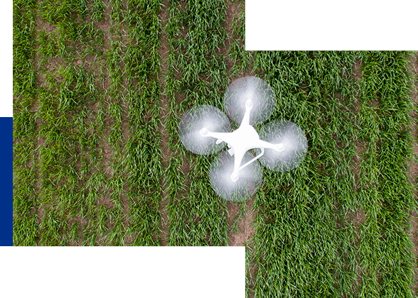
This micro-credential explores Geographic Information Systems (GIS) and remote sensing methods through real-world scenarios. Participants will explore impactful applications, such as the use of time series satellite data in measuring climate change impacts, or blue carbon hotspots. After completion, participants will be better prepared to apply GIS and remote sensing to environmental scenarios. These skills can be integrated into various aspects of environmental analysis and change assessment.
- Delivery mode
- Online
- Start date
- 28 February 2022
- Duration
- 12 weeks
- Effort
- 150 hours
- Cost
- $990 inc. GST
- Critical information summary
- ENVTM5050 GIS and Remote Sensing in a Changing World (PDF 98KB)
What you'll learn
Understand the complexities of spatial data.
Apply GIS and remote sensing to a real-world environmental scenario.
Communicate the geoprocessing method and environmental assessment in written and visual formats.

Why study this course?
- Apply GIS and remote sensing data to environmental monitoring.
- Understand the complexities of spatial data, including recognising different types of spatial data, and applying correct projections and transformations to spatial data.
- Develop a geoprocessing model that uses spatial data and multiple spatial techniques to evaluate environmental questions.
- Communicate the geoprocessing method and environmental assessment in written and visual formats.
Who should study this course
People who want to apply GIS and remote sensing to environmental monitoring and and change assessments.
Prospective students in Master of Agricultural Economics, Master of Agricultural Science, Master of Biotechnology and Master of Environmental Science.
How does it work?
Participants will complete practical exercises and a report with written and visual components.
What's next after this course?
- Future study
- Students who complete this micro-credential can apply for advanced standing if they subsequently apply for a Master of Agricultural Economics, Master of Agricultural Science, Master of Biotechnology or Master of Environmental Science.
- Career outcomes Positions requiring the use of GIS and remote sensing, or environmental monitoring and change assessments.
Frequently asked questions
- What are micro-credentials?
-
Micro-credentials are short courses. Successfully completing a micro-credential showcases mastery of specific skills, knowledge and/or experience in a given subject area or capability. Designed to meet students’ flexibility requirements, micro-credentials focus on skills that are in high demand by employers and industry, and provide the opportunity for you to update, upskill or reskill in specific areas. UWA Plus micro-credentials are delivered by UWA or by an external provider via an agreement with UWA.
UWA Plus short courses are also short courses focused on specific skills or knowledge in a given area. Unlike micro-credentials, UWA Plus short courses are not stackable for conversion to academic credit.
- Are micro-credentials right for me?
-
If you’re interested in upskilling in a specific area with the option of gaining university credit, micro-credentials may be right for you. Check the specific micro-credential listing for details.
- How is a micro-credential different from other types of study?
-
Micro-credentials are short, specific courses designed to be stackable. They give you the flexibility to pick and choose what works for you, so you can complete a one-off micro-credential or stack multiple micro-credentials to convert to academic credit towards an undergraduate or postgraduate course.
UWA Plus short courses are also short, specific courses - but are not stackable to convert to academic credit.
- What are ‘stackable’ micro-credentials?
-
Micro-credentials are ‘stackable’ because you can combine multiple micro-credentials that may be converted to academic credit towards an undergraduate or postgraduate course.
- Why are micro-credentials valuable?
-
Successfully completing a micro-credential showcases mastery of specific skills or knowledge. Micro-credentials contribute to your skillset and employability, and create pathways for continued learning.
- Do I need any previous knowledge of the topic?
-
Many UWA Plus micro-credentials do not require significant previous knowledge, but check the specific micro-credential listing for any recommended prior knowledge.
- How long does it take to earn a micro-credential?
-
UWA Plus micro-credentials vary in length and delivery mode. They may be offered intensively over a number of consecutive days, or via weekly content over several weeks. Check the specific micro-credential listing for details.
- Do I have to come to campus?
-
UWA Plus micro-credentials may be delivered fully online, on-campus in face-to-face classes, or by a combination of both. Check the specific micro-credential listing for details.
- I live outside Australia, am I eligible to enrol in a micro-credential?
-
Yes, all micro-credentials are delivered in Australia, but if the micro-credential is fully online, you may enrol and complete the micro-credential from anywhere.
- Can I study micro-credentials under my international student visa?
-
Yes, but in accordance with Education Services for Overseas Students (ESOS) regulations.
- I am on a visitor’s visa, but am really interested in upskilling. Am I eligible to enrol in a micro-credential?
-
Yes, subject to the terms of your visa.
- Can you register for more than one micro-credential at any one time?
-
Yes, you may enrol in more than one micro-credential at the same time.
- Will what I learn in a micro-credential be relevant to my job?
-
Yes, micro-credentials focus on skills that are in high demand by employers and are endorsed by industry. Your employer may even consider covering the fee for the micro-credential as part of your professional development. Your employer may have a discount arrangement with UWA, so check with your employer.
- Will micro-credentials give me university credit?
-
Completing micro-credentials through UWA Plus or UWA+ Starter earns Professional Development Points (PD Points) that can convert into academic credit when commencing undergraduate or postgraduate courses at UWA. (Entry into award courses requires eligibility requirements to be met). Each PD Point is comparable to one academic credit point.
Micro-credentials at UWA can be stacked towards credit for an elective undergraduate or postgraduate unit at UWA. Students would need to accumulate 6 PD Points to convert to academic credit for a 6 point elective unit.
In addition, some micro-credentials can earn credit towards specific units which will be noted in the 'What's next after this course?' on the micro-credential webpage.
- Can I use academic credit from micro-credentials toward my current undergraduate or postgraduate course?
-
No, micro-credentials may only be converted to academic credit when commencing an undergraduate or postgraduate course. If you are a current student in an undergraduate or postgraduate course, you may still take micro-credentials to be converted towards future studies.
- Does academic credit from micro-credentials have an expiry date?
-
The time period for conversion of a micro-credential to academic credit is five years from the date of completion.
- Can I obtain credit toward UWA Plus micro-credentials from my previous studies?
-
No, UWA Plus micro-credentials earn PD Points. Previous studies do not contribute toward PD Points.
- How much do micro-credentials cost?
-
Micro-credential fees are included with each specific micro-credential listing. Fees are stated in Australian dollars and are operated on an individual-funded or organisation-funded basis. They are not government subsidised (unless specified otherwise) and include a GST component.
- Is there any government support for micro-credential fees?
-
No, micro-credential fees are not government subsidised and are not eligible for the Higher Education Loan Program. Micro-credentials are fully individual-funded or organisation-funded professional development short courses.
- How do I enrol?
-
From the micro-credential listing, click on Register Now, complete your details, agree to the Terms and conditions, and complete payment. Once your registration has been processed, you will receive an email with a link to complete your enrolment and access the micro-credential resources.
- How do I pay?
-
After completing your registration details from the micro-credential listing and agreeing to the Terms and Conditions, click on Process Payment to link to the secure payment portal where you can pay via Mastercard or Visa.
- How do I access micro-credential resources?
-
Once your registration has been processed, you will receive an email providing information on how you can gain access to your course on the UWA learning management system where all the relevant micro-credential materials are located.
- Will I be registered with the University? What access to student services will I have?
-
Yes, if you are enrolled in a UWA Plus micro-credential you will receive a UWA Student Number (if you don’t have one already) and will have access to UWA student services and facilities while you remain enrolled.
- Will I get access to the UWA libraries if I register for a micro-credential?
-
Yes, if you are enrolled in a UWA Plus micro-credential you will have access to UWA libraries.
- Will I get a certificate?
-
Upon satisfactory completion of a micro-credential:
- you’ll receive a Certificate of Achievement. You should also download the Critical Information Summary for the micro-credential, which includes important information for employers about the micro-credential.
- the micro-credential will be added to your UWA Plus Professional Development (PD) Transcript. Your PD Transcript will record all micro-credentials completed through UWA Plus.
- you’ll gain Professional Development Points (PD Points) that may be converted to academic credit towards undergraduate or postgraduate courses.
- Will I attend a graduation ceremony to receive my Certificate of Achievement?
-
No, micro-credentials are not included in UWA graduation ceremonies.
- How do I get my certificate and Professional Development (PD) Transcript?
-
Your Certificate of Achievement will be posted to you.
Your official PD Transcript will be made available electronically to view or share from My eQuals free of charge. You will be able to order and pay for a hard copy of your PD Transcript if you would like to do so through the online Academic Documents ordering process.
- If I have enrolled but can’t participate in the micro-credential, can I get a refund?
-
- Withdrawals will be refunded up to two weeks prior to commencement of the micro-credential.
- Please choose carefully, as we do not offer a refund if you change your mind or find yourself unable to attend after this time period.
- If you are unable to complete the micro-credential in exceptional circumstances (including severe ill-health or on compassionate grounds), you can apply to withdraw with a refund with relevant documentation. The application must be made prior to having received a certificate of achievement.
- Application to withdraw from a micro-credential with a refund must be made in writing by emailing [email protected].
- Any additional fees incurred during the process of completing the payment (e.g. credit card surcharge, bank fee, merchant fee, etc.) will not be refunded.
- If I apply for a micro-credential, how much time will I have to change my mind?
-
- Withdrawals will only be refunded up to two weeks prior to commencement of the micro-credential.
- Please choose carefully, as we do not offer a refund if you change your mind or find yourself unable to attend after this time period.
- Will I get a refund if the University cancels the micro-credential?
-
If the University is not able to offer an advertised micro-credential after you have enrolled in it and paid for it, you will have the choice of transferring to an acceptable equivalent micro-credential or receiving a refund.
- Who can I contact if I have any questions?
-
Get in touch with the UWA Plus team by emailing [email protected], or speak to a Future Students Adviser from 8am to 5.30pm, Monday to Friday (Western Standard Time) by calling 131 UWA (131 892). You can also visit us in person at Student Central from Monday to Friday, 8.30am – 5pm.
Who you'll learn from

Dr Sharyn Hickey
Dr Sharyn Hickey’s research interests focus on geographical elements of environmental systems, and how spatial and temporal models can examine environmental change and the drivers of change.