FACILITY
Remotely Piloted Aerial Sensing Platform
Taking research to new heights
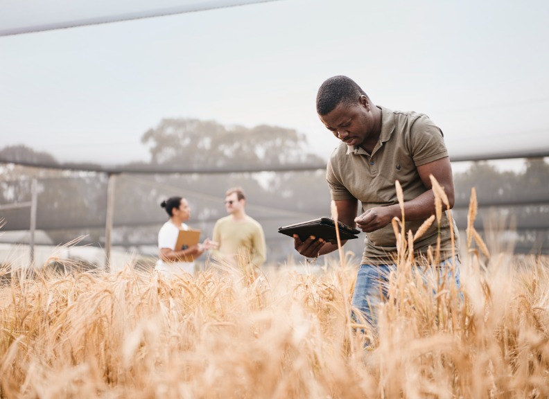
UWA’s Remote Aerial Sensing Platform provides operational infrastructure, expertise, support and advice for drone and environmental sensing. The facility provides the capacity for research collaboration, brings expertise and licencing to a UWA research group, and makes drones, sensors and other equipment available for other external projects.
The facility is home to one of a limited number of Civil Aviation Safety Authority licenced groups conducting drone remote sensing research in Australia. It is licenced to operate up to 25kg multi rotor drones.
The facility is also one of few university research groups in Australia with a Distributed Temperature Sensing (DTS) capacity and in-house optic fibre preparation with splicing capability to support environmental studies.
The facility’s comprehensive technology and capabilities include:
- Modifying drones and 3D printing parts to provide novel capacity
- Undertaking in-field and laboratory hyperspectral profiling to build spectral libraries for remote sensing
- Spectral, thermal and photogrammetry processing
The facility has a range of flexible photography, multi-spectral and thermal sensors that can be deployed on UWA’s drones or can be hired. Drones are available for hire by remote pilot licence (RePL) trained pilots, operating under a Civil Aviation Safety Authority (CASA) Remote Operators Certificate (ReOC).
Facility services
UWA researchers have access to hire our advanced technology which includes:
- Drone sensors including drone thermal (TeAX FLIR Tau 2 640*480) and multispectral (4- and 6-band Parrot Sequoia and Tetracam Micro MCA sensors), and are available for hire and can be flown on external Drone platforms.
- Hyperspectral field spectrometer (ASD Fieldspec 4)
- Distributed Temperature Sensing (Silixia XT) and optic-fibre fusion splicer (AFL Fujikura 70S and CT30A cleaver)
- DJI Phantom 4 Advanced; DJI M600 Pro Drones available for hire to insured remote pilot licence (RePL) trained pilots operating under an external Civil Aviation Safety Authority Remote Operators Certificate (ReOC)
- We have a group of collaborating UWA staff, PhD students and postdoctoral researchers who hold remote pilot licence (RePL) and operate under our CASA Remote Operators Certificate (ReOC), with some capacity for external collaboration and fee-for-service work.
Licencing
Inductions and licencing are required to hire and operate equipment from the Remote Aerial Sensing Platform:
- Hyperspectral field spectrometer (FieldSpec 4): requires two to three hours’ training
- Drone sensors: available for hire when flown by an insured, external provider using their drone platform
- Drones – CASA and UWA classifies any research work with Drones as commercial work, and requires a Remote Pilot Licence (RePL), and operated under a CASA Remote Operators Certificate (ReOC).
- available for external hire when flown by an insured, licenced pilot (RePL), operating under a CASA ReOC.
- collaborating staff, PhD students and postdoctoral researchers holding a RePL inducted onto the UWA Geography Remote Operators Certificate (ReOC), operating under the Chief Remote Pilot.
Equipment Hire
Our facility offers a range of equipment to support UWA researchers with state-of-the-art technology, creating opportunities for innovative, collaborative research. UWA researchers have access to hire our advanced technology. Inductions and licencing are required to hire and operate equipment from the Remote Aerial Sensing Platform.
To book and hire equipment:
- Download and complete the Hire Agreement form [Docx 143KB]
- Submit your completed form to [email protected]
Collaborations
Our facilities and equipment support UWA researchers with state-of-the-art technology, creating opportunities for innovative, collaborative research. Some of the projects we are involved with include:
- Cooperative Research Centre for Honey Bee Products project on drone sensing of flowering, forage and climate patterns
- Collaborative project with the School of Biological Sciences and Kings Park using Distributed Temperature Sensing for fire and seed ecology research
- UWA Oceans Institute and AIMS on mapping mangroves and coastal carbon stocks
- GRDC monitoring frost in crops using DTS
- Working with Snowy Hydro and University of Queensland researchers using drones to identify snow depth and snow redistribution including the role of trees in the alps
- Mapping sedimentary deposits recording the cyclone history of the Northwest cape area with collaborators from the University of Cologne (Germany)
- ARC supported work on mapping palaeoclimate archives in the Kimberly region of WA over the last 60,000 years

Contact the UWA School of Agriculture and Environment
For more information about the facility, contact Dr Nik Callow